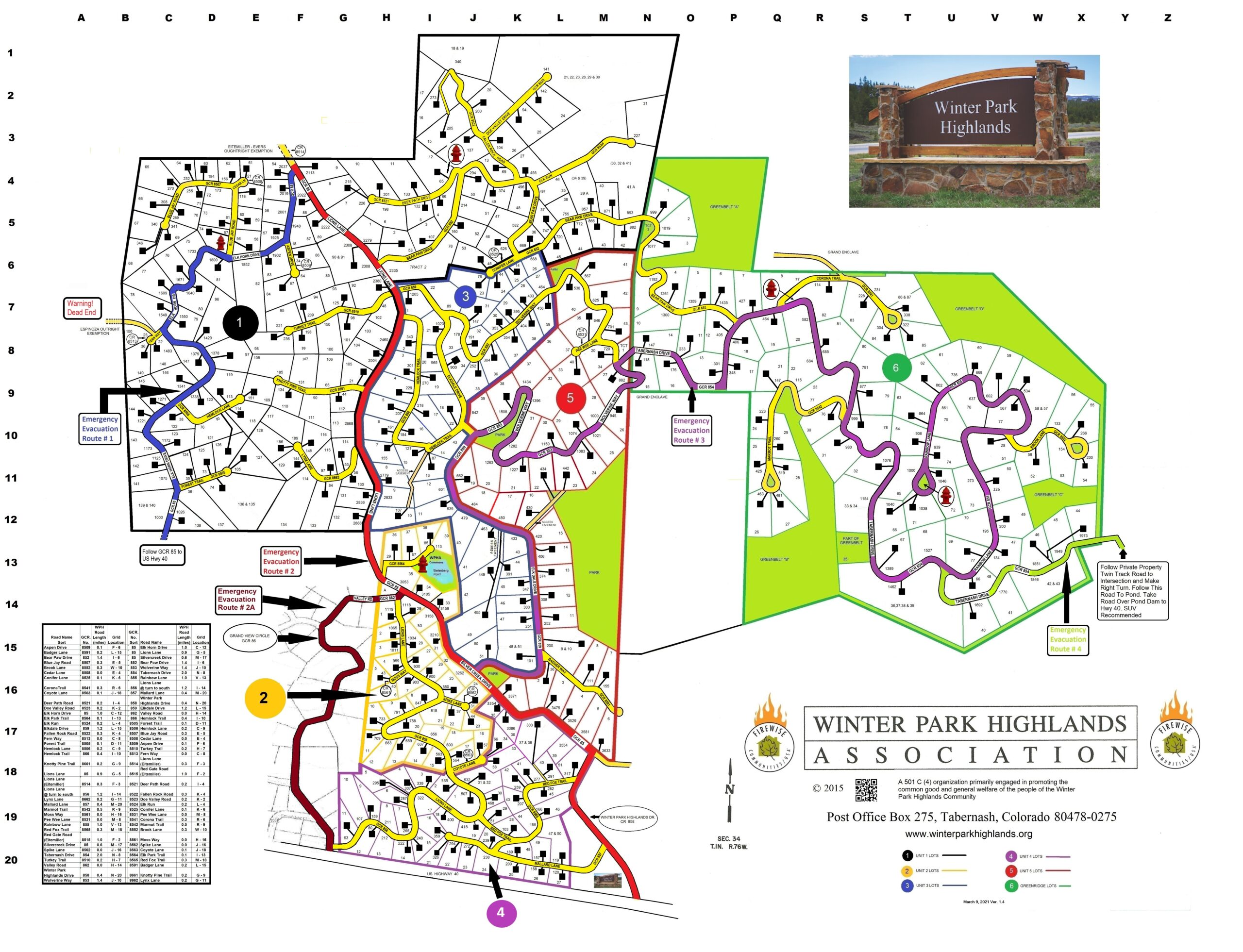
The new, revised map includes emergency evacuation routes out of the Highlands and all cistern locations.
To see all the detail in this map or any of the others, you can open the image in a new tab or download it to your device.
Want to own a copy of this beautiful color-coded map of the Highlands? Now you can! WPHA has arranged with McConnell Design & Print Co. of Winter Park, CO to offer several versions of the new map. The maps can be picked up at their office in downtown Winter Park or mailed directly to you.
1. Version 1 of the map measures 19” by 24” and is printed on Glossy Paper (suitable for framing). $20.00, working time 3-4 days. 2. Version 2 is printed on regular paper and is also 19” by 24”. $15.00, working time 3-4 days. 3. Version 3 is printed on glossy Paper and measures 13” by 19”. $5.00, working time 1 day. 4. Version 4 is printed on regular paper and measures 13” by 19” $4.00 working time 1 day
All prices shown above are for pickup at the McConnell’s Winter Park, CO location. Shipping and handling with mailing tube to lower 48 states $18.00.
To order one of these maps contact Ryan at:
McConnell Design & Printing Co. Mailing Address PO Box 1326 Physical Address 78878 US Highway 40 Winter Park, CO 80482 970-726-5830 ryan@mcdesignprint.com
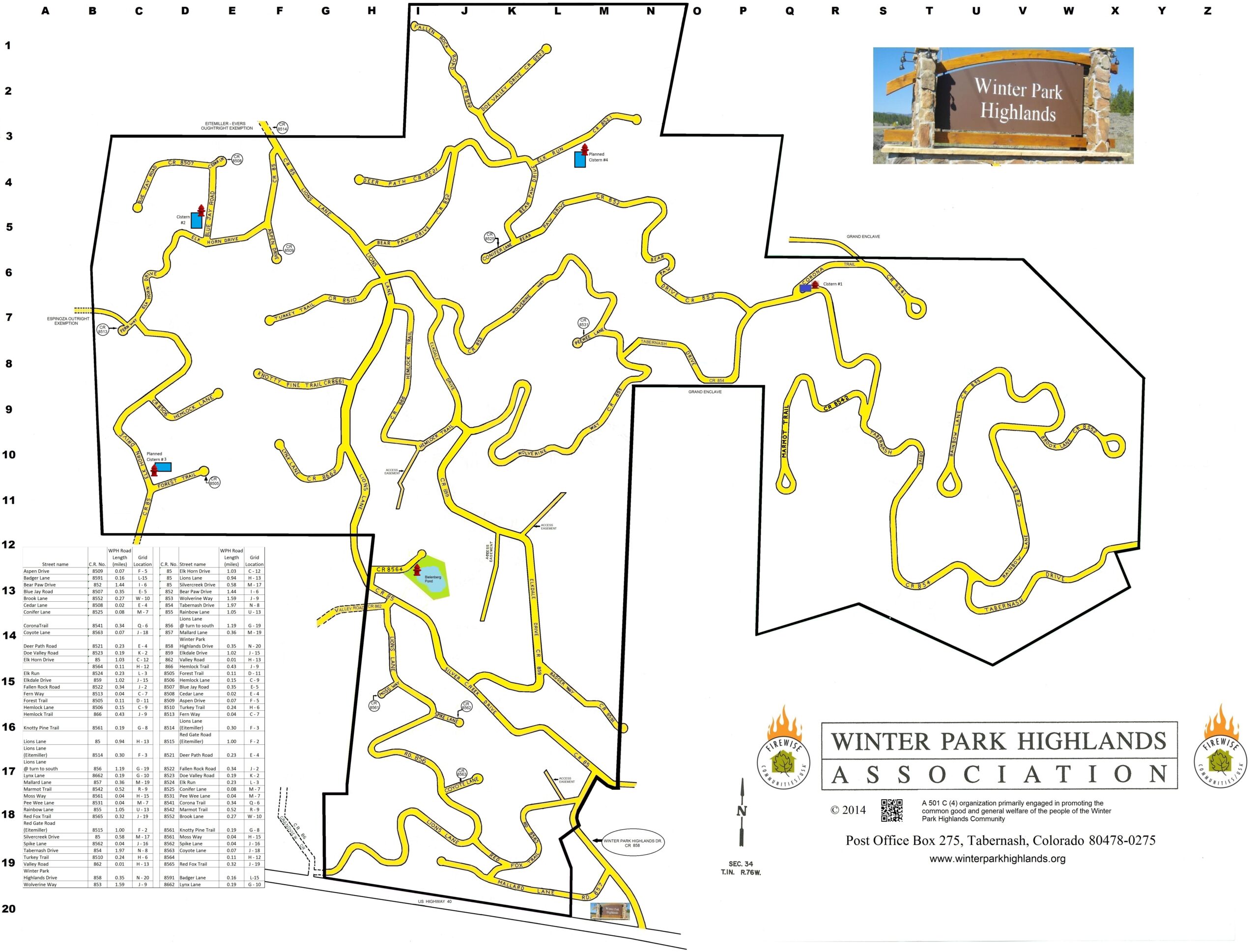
WPH roads
A road map of the community, with a decoder to translate between road names and GCR road numbers. Zoom in or download the image to see the decoder table.
Firewise community boundary
Includes the locations of cisterns and Bielenburg Pond.
We thank CompassData for their help in creating this map.
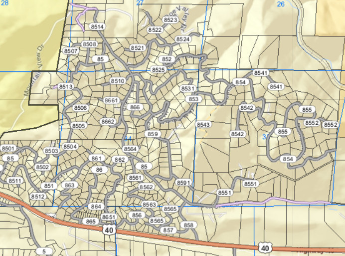
Grand County parcel viewer
The Grand County parcel viewer online map offers granular property-specific data. You can find the property tax assessment history, ownership transfers of a parcel over the years, and more in these public records.
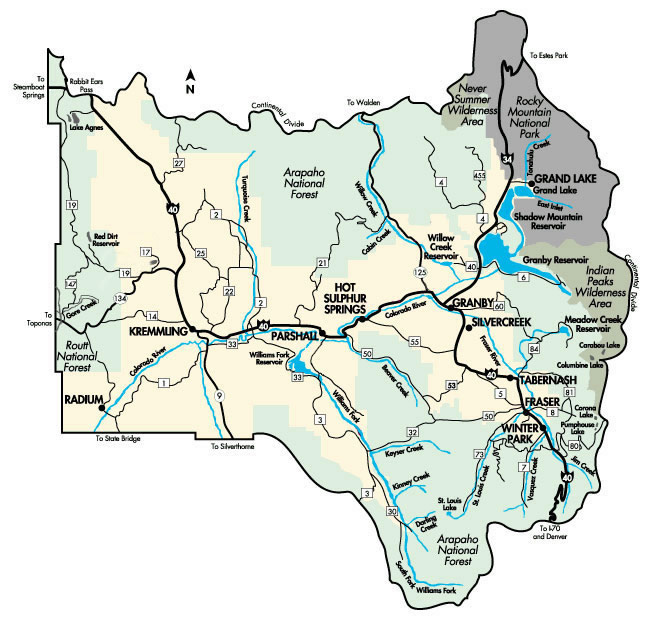
Grand County map
Basic map of the cities and highways in the county.